Weather forecast for 164327 places
Search your place or city
Search your place or city


Meteo Menu
Current weather + forecast for today
Radar Zubūbah
Reliable forecast for temperature, precipitation, cloud and wind


Radar and current precipitation for Zubūbah
Radar precipitation and cloud cover for the location of the calculation coordinates: 32.544 LAT 35.223 LON
Meteoblue radar maps capture cloud cover (white layer of the map) or total precipitation in a range of 4 intensity levels (drizzle, light, medium and heavy precipitation) over the area focused around the location Zubūbah. You can zoom in and out of the radar map by using the mouse wheel. There is no cloud cover where there is no color layer, but only the classic map relief. Radar images and precipitation trends can be displayed up to 3 hours backwards and can be viewed over the entire planet Earth.
radar maps meteoblue
|
The Meteoblue forecast was originally developed at the University of Basel, Switzerland, based on NOAA/NCEP models. Meteoblue forecasts quickly became popular with scientists and the public with a specific interest in meteorology, including climbers, (hobby) pilots and astronomers. YouTube video history of Meteoblue development |
|
|---|


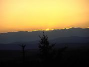


Beautiful photos of nature as the wallpapers for your desktop


© 2010 - 2024 Evaluate Dynamics s.r.o. and content providers
Weather Sunshine and the website logo is a trademark
Contact the developers of this website + Impressum
Content can be free distributed according to CC BY 4.0
ePrivacy | Changing GDPR consent | RSS
General conditions of use |  Počasí Zubūbah radar